The Matterhorn - "z'Horu"
The Matterhorn, a landmark for Zermatt and the whole of Switzerland
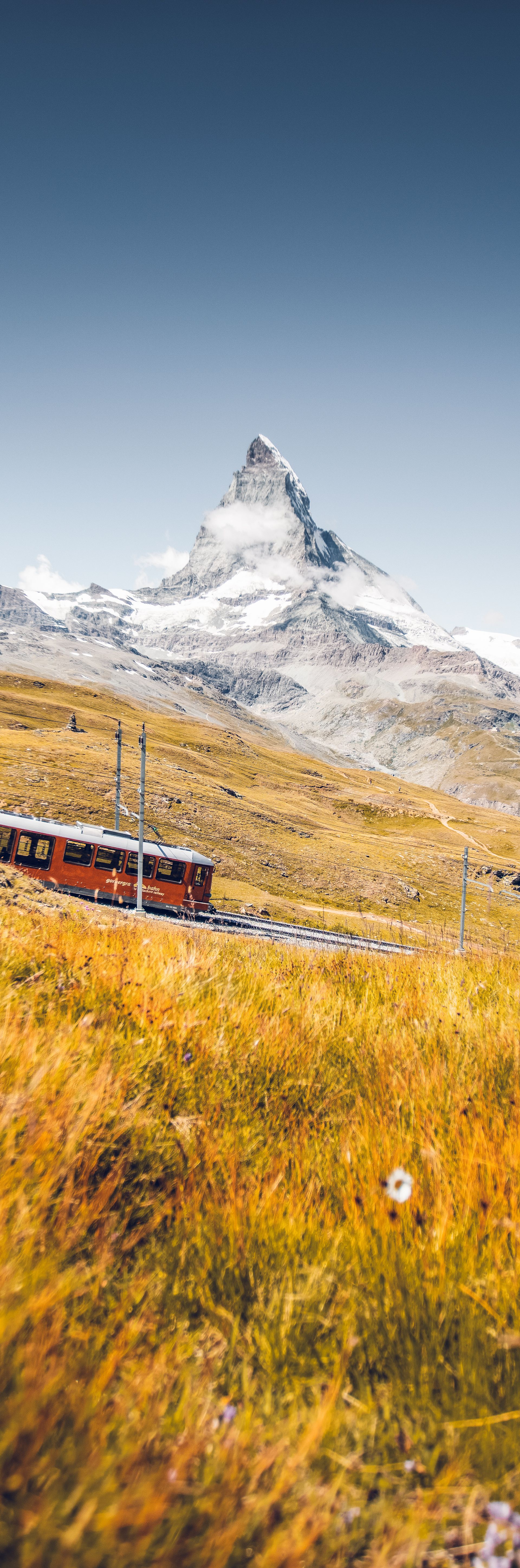
The Matterhorn is 4,478m high and counts as one of the Alps’ and therefore also Switzerland’s highest peaks. It is also THE Swiss emblem and the world’s most-photographed mountain. The ‘mountain of mountains’ is the focal point in the Zermatt region and the Mattertal valley. Like a magnetic triangle, the ‘Horu’ (the locals’ name) draws everyone’s eyes towards it and it is photographed and filmed thousands of times. The impressive, sheer rock walls are unique, towering in isolation from the rest of the peaks.
Facts and Figures about the Matterhorn
Height: 4478 m
First ascent : 14. July 1865
First ascenders : Edward Whymper, Douglas R. Hadow, Charles Hudson, Francis Douglas, Michel-Auguste Croz, Peter Taugwalder senior, Peter Taugwalder junior. Deaths during the descent: Douglas R. Hadow, Charles Hudson, Francis Douglas and Michel-Auguste Croz. Departure for the ascent: Hörnlihütte
Tips for climbers:
A mountain guide is necessary
The climb is only for the sure-footed with a head for heights
Basic requirements: good physical condition and stamina
2-day tour recommended with one overnight stay at the Hörnlihütte lodge
Where does the name "Matterhorn" come from?
The locals call the Matterhorn ‘Hore’ or ‘Horu’ in their Valaisian dialect; in Italy they call it Monte Cervino or Cervino and in French it becomes Mont Cervin or Le Cervin. The name ‘Matterhorn’ is derived from the meadows beneath the mountain. The meadow beneath the Gornerschlucht gorge refers to that part where today Zermatt is located (on the ‘Matte’). In Valaisian dialect a meadow is a ‘Matte’, and thus the name comprises Matte + Horn (a meadow and a peak).
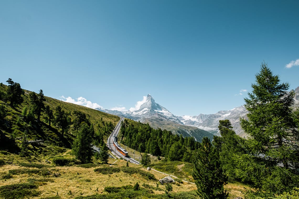
The Gornergrat Bahn in the panoramic curve above Riffelalp with a view of the Matterhorn
The first ascent of the Matterhorn
On 13. July 1865 eight climbers set off in the early morning towards the Matterhorn. Edward Whymper, Charles Hudson, Lord Francis Douglas, Robert Hadow and three local mountain guides: Michel Croz, Peter Taugwalder and his son, Peter. Going via the Schwarzsee lake they began their ascent over the ridge towards Hörnli and then climbed up to the east face where they set up their tents. While Croz and the younger Taugwalder reconnoitred the route further up, the remainder of the group prepared for their ascent the following day. At the same time, on the Italian side, Jean-Antoine Carell and his companions had been preparing for a Matterhorn ascent for three days and so speed was of the essence. On 14. July 1865 at 13.15 the first ascent was accomplished. A climb apparently without any great problems and the group were extremely proud of their achievement. The Englishmen tied an old shirt onto a stick and hoisted their ‘flag’ on the summit. They could make out the Italian group further down the mountain.
After about an hour on the summit they got ready to descend. Only 300 metres below the summit Hadow slipped and fell onto the first mountain guide, Croz. They fell down the face together dragging the two Englishmen Hudson and Douglas with them on the rope. With great presence of mind, Taugwalder senior threw the rope around a rock, but the rope between him and Douglas wouldn’t hold and it ripped. The four mountaineers tumbled down to the Matterhorn glacier and thus became the first victims of climbing on the Matterhorn. Whymper survived this earliest ascent and is celebrated at the first man to reach the top of the Matterhorn.
Matterhorn climbing routes
The 4,478m Matterhorn is one of the most difficult of the 4,000 classic Swiss climbs. Mountaineers need to be extremely fit and have had experience with climbing over rock without crampons. The ascent and descent normally go via the Hörnligrat ridge (the north-east ridge) with an overnight stay in the Hörnlihütte lodge. However, there is also a route from the Italian side going over the Liongrat ridge.
The ascent from the hut to the summit takes between 4 and 5 hours. For the descent of the more than 1200 metres in altitude, you have to allow about the same amount of time again.
The Hörnli hut - base camp for the Matterhorn
The first accommodation on Hörnli was built in 1880 and provided 17 beds and since then has served as overnight accommodation for many climbers. After several re-builds the lodge was expanded in 1982 providing 170 beds for climbers. Just in time for its 150th anniversary the Hörnlihütte lodge was rebuilt and totally renovated in 2015; it is open from July to September. The Hörnlihütte has a total of 34 rooms and can accommodate 170 overnight guests. There are rooms with 3, 4, 6 or 8 beds and WC's as well as showers on the floor. There are also two suites with their own shower and toilet. A lounge and Wifi are also part of the equipment of the Hörnlihütte.
Hiking to the Hörnli hut
The Hörnli Hut can be reached in about a two-hour hike from Schwarzsee. It lies at 3260 metres above sea level.
The hut can be reached via an approximately two-hour hike from Schwarzsee. The route offers spectacular views of the Matterhorn and is a highlight in its own right for keen hikers.
How Was the Matterhorn Formed?
The Matterhorn, one of the world’s most iconic mountains, owes its distinctive shape to a dramatic geological history. What many people don’t know is that the summit of the Matterhorn is made of rock that originally belonged to the African continental plate.
Millions of years ago, the African and European continental plates collided. The immense forces involved folded, uplifted and displaced vast masses of rock, which were later sculpted by glaciers and erosion. This process created the striking pyramid-shaped silhouette that has made the Matterhorn one of the most photographed mountains in the world.
The Geological Formation of the Matterhorn
Continental drift
More than 100 million years ago, the landmasses began to move apart. An ocean – the Tethys – opened up between Europe (Eurasia) and Africa/Adria.
Collision of the continents
Around 40 million years ago, the direction of movement changed, and Africa and Adria began moving towards Europe again. During this process, the oceanic crust of the Piemont Ocean was subducted beneath the African continent, causing massive folding and uplift.
Mountain building
The collision between Eurasia and Africa caused the Earth’s crust to thicken considerably. The former Briançon microcontinent, a lighter body of rock, was pushed upwards. This marked the beginning of the formation of the Alpine mountain range we know today.
Erosion shapes the Matterhorn
Over millions of years, wind, water and glaciers gradually exposed and sculpted the Matterhorn. The boundary between the two original continents can still be seen today as a dark line near the base of the mountain.
The Matterhorn Today
The formation of the Alps is not yet complete: the region continues to rise by up to 1.5 mm per year – which would amount to 1.5 kilometres over a million years! At the same time, erosion continues to reshape the Matterhorn.
Where Does the Name “Matterhorn” Come From?
The name Matterhorn is derived from the German words “Matte” (meadow) and “Horn” (peak). The name refers to a meadow below the mountain, where the village of Zermatt (“zur Matte”, meaning “at the meadow”) stands today. In earlier times, this area was an alpine meadow used by local farmers. The striking peak rising above this “Matte” therefore became known as the Matterhorn.
In the local Valais dialect, the Matterhorn is affectionately known as the “Horu”. This shortened form is deeply rooted in the traditions of the region and is still commonly used by locals today.
Internationally, the Matterhorn is known by several different names. In Italian, it is called Monte Cervino, while in French it is known as Mont Cervin. These names are thought to derive from the Latin term “Silvius”, associated with “forest” or “wooded area”. Although the Matterhorn itself is not forested today, the name may originally have referred to the wooded lower slopes and valleys of the surrounding region.